Nepal Trip Day 5 - Monjo to Namche Bazar (Thursday December 27, 2018)
Nepal Trip Day 5 - Monjo to Namche Bazar (Thursday December 27, 2018)
We will trek to Namche today, a major trading village in the Khumbu region. Namche is situated at 11,286 feet or 3,440 meters. We will be staying at Namche for three nights. On the second day at Namche we plan to hike to Hotel Everest View situated at 12,999 feet or 3,962 meters. This leg of our journey will put our acclimation routine to the test.
We woke up and got ready before 7:00. We asked Mingma to start the trek early today at around 8:00 so we can get to Namche around lunch time. We were served full breakfast with muesli, cereal, toast, omelette, yak butter, juice, tea, and coffee. We finished up and were on our way around 8:20 am. Today's weather seems to be colder and more ominous than the last few days. It was cloudy. I was again getting worried about the ascent to Namche in potential snowy condition.
Table is set for breakfast

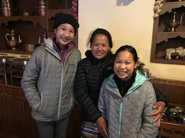
For some reason there's affection between the two

Yak butter

Home made toast

Omelette

Omelette and coffee

Photo with the lodge staff
Got moving shortly after 8:00 am

The weather looking ominous

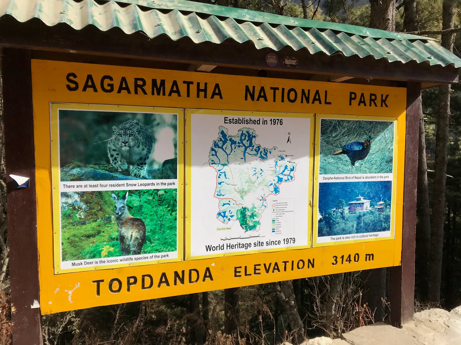
After passing couple of lodges, we were descending to the river bank of the Dudh Kosi River. Right before the descent, we were greeted by the official entrance to the Sagarmatha National Park.
Sagarmatha National Park
Sagarmatha is the Napali name for Mount Everest. The region surrounding Mount Everest has been designated as the Sagarmatha National Park since 1976. We would be following the foot steps of Tenzing Norgay, Edmond Hillary and other great mountaineers who pioneered this region for modern exploration.

Sagarmatha is the Napali name for Mount Everest. The region surrounding Mount Everest has been designated as the Sagarmatha National Park since 1976. We would be following the foot steps of Tenzing Norgay, Edmond Hillary and other great mountaineers who pioneered this region for modern exploration.
Descending into the Sagarmatha National Park zone

I was moving slowly down the large stone steps

At the entrance of Sagarmatha National Park

Ominous cloud covering us today


Crossing another suspension bridge


View of the village Jorsalle from the suspension bridge

Snapping a quick photo on the bridge

Entering Jorsalle

Trekking through Jorsalle, a popular lunch stop for trekkers

A typical lunch spot

A porter carrying large loads

Trekking through lodges in Jorsale

Crossing another suspension bridge back to the right bank of the river


Trekking along the riverbank, at this point a dog decided to join us

Finally the new Hillary Bridge is in view (the one on top)

Continuing with the riverbank hike towards the new Hillary Bridge


Taking a few more photos before the ascent to the new Hillary Bridge


View of the iconic new Hillary Bridge

Zoomed in view of the new Hillary Bridge

Taking one last look before the ascent

Making our ascent towards the bridge

Gaining elevation

Almost at the bridge

We are at the bridge

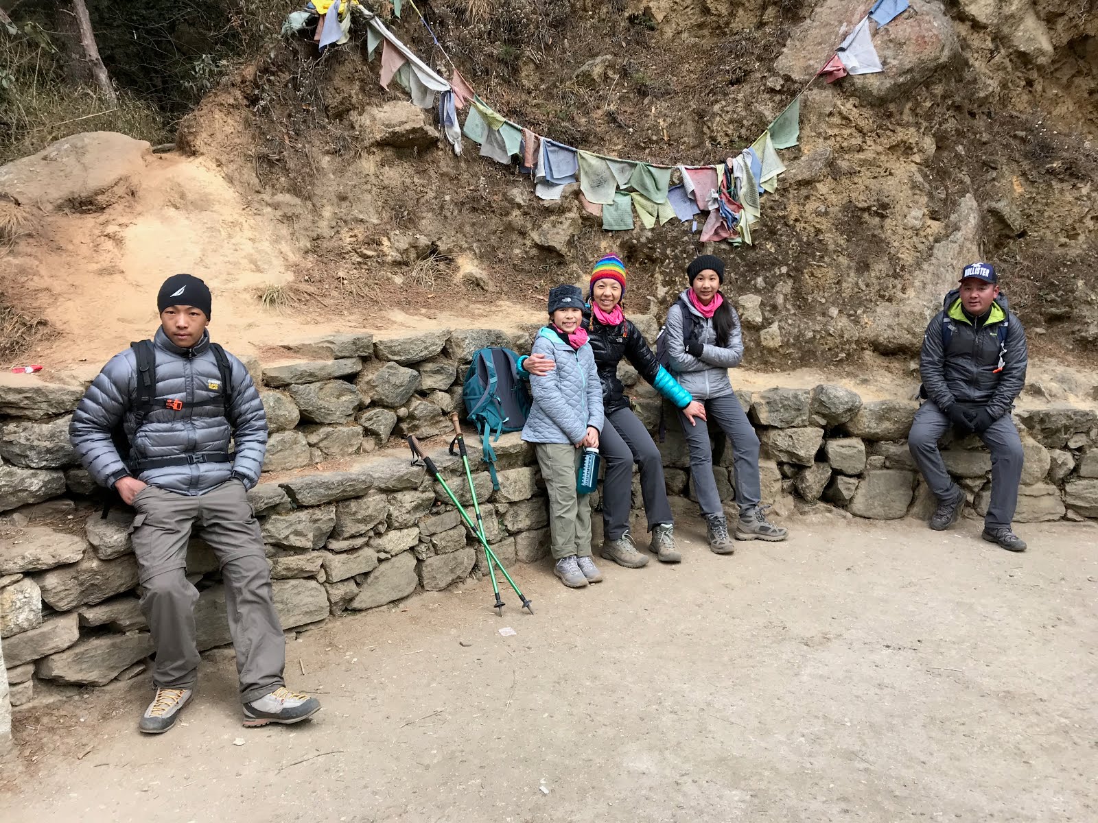
Taking a quick water break before we cross

Our hard working trek porters - Tenzing and Lapsang

At the foot of the bridge

The dog that had been following us

Prayer flags on the bridge

Crossing the bridge

Looking back down at the valley where we came from (south)

Looking the other way (north) and seeing Thamserku


After we crossed the Hillary Bridge, we steadily gained elevation. The hike seemed like an endless uphill switch back with no end in sight. This is where people can be a mental block and potentially quit. The endless uphill switch backs coupled with high elevation makes this stretch of the hike the most mentally challenging portion of the trek for us.
Crossing the 10,000 feet mark according to my watch

Looking back at the valley with sun shining through the cloud as we gain elevation


A young child peeking through the door of a Cafe

Goats resting on the trail

Another young child saying hello to us

Map of Namche as we enter the town

Making the final turn into Namche

Namche Bazar

Panoramic view of Namche Bazar

MM finally made it!


Vegetable soup-dinner

Chicken

Fried rice

Vegetable stew

Vegetarian noodle

Sweet rice dessert


Ominous cloud covering us today

After the passed the entrance gate, Mingma took our passports to settle the entry permits for us. We followed our assistant guide Geylzen through numerous cultural relics and eventually descended all the way down to the river bank of the Dudh Kosi River. We would follow the river bank until we see the view point of the new Hillary Bridge. We would then ascend to cross the new Hillary Bridge and follow the trail to Namche.
A Tibetan style gate with prayer wheels inside

Begin our descent down to the Dudh Kosi River

Following Gelyzen down the large stone steps

Leveling out near a lodge

Crossing another suspension bridge


View of the village Jorsalle from the suspension bridge

Snapping a quick photo on the bridge

Entering Jorsalle

Trekking through Jorsalle, a popular lunch stop for trekkers

A typical lunch spot

A porter carrying large loads

Trekking through lodges in Jorsale

Crossing another suspension bridge back to the right bank of the river

View of the Dudh Kosi River from the suspension bridge


Finally the new Hillary Bridge is in view (the one on top)

Continuing with the riverbank hike towards the new Hillary Bridge


Taking a few more photos before the ascent to the new Hillary Bridge


View of the iconic new Hillary Bridge
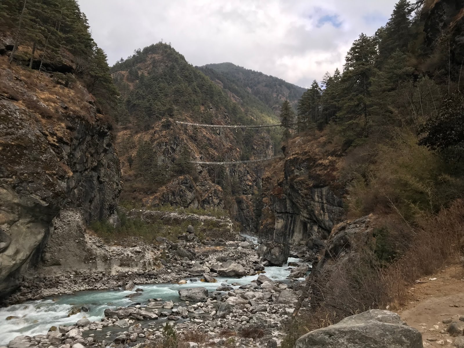
Zoomed in view of the new Hillary Bridge

Taking one last look before the ascent

Making our ascent towards the bridge

Gaining elevation

Almost at the bridge

We are at the bridge

Taking a quick water break before we cross
Our hard working trek porters - Tenzing and Lapsang

At the foot of the bridge

The dog that had been following us

Prayer flags on the bridge

Crossing the bridge

Looking back down at the valley where we came from (south)

Looking the other way (north) and seeing Thamserku


After we crossed the Hillary Bridge, we steadily gained elevation. The hike seemed like an endless uphill switch back with no end in sight. This is where people can be a mental block and potentially quit. The endless uphill switch backs coupled with high elevation makes this stretch of the hike the most mentally challenging portion of the trek for us.
Crossing the 10,000 feet mark according to my watch

Looking back at the valley with sun shining through the cloud as we gain elevation

After taking in countless switchbacks, we finally reached the first view point of Mount Everest - the Topdanda view point. We took a quick break there. Mount Everest was covered by cloud so we could not see it today. We saw other trekkers coming up and down through this view point. We began to feel the temperature getting colder as the elevation was getting higher.
Topdanda view point at 3140 m
View of Mount Everest covered by cloud


After more punishing uphill hike and crossing an ice patch, we finally reached the edge of Namche. Mingma had to help us with more paperwork as we entered Namche. We followed Geylzen up the hill. Our hotel was located at the vantage point of Namche - meaning at the highest elevation of Namche. This fact was a bit hard to take in for the kids but everyone powered through it. We crossed Namche and up the hill to our lodge. We finally made it in to YMH Namche at just before 1 am. It took us about four and half hours to complete this trek today.
Relentless dirt trail up to Namche

Frozen waterfalls from Kongde Ri seen from the trail

Peaks of Kongde Ri peeking through the cloud

Frozen waterfall from Kongde

Check point to enter Namche Bazar

Taking a short break

Making the final push to our lodge from the check point of Namche

MM staring at the endless stone steps

Dramatic view of lower Namche

GG is still holding up

Panoramic view of lower Namche

A young child peeking through the door of a Cafe

Goats resting on the trail

Another young child saying hello to us

Map of Namche as we enter the town

Making the final turn into Namche

Namche Bazar

Panoramic view of Namche Bazar

MM finally made it!

At the Tibetan style gate into Namche

Main Stupa of Namche

Large hydraulic powered prayer wheels spinning on the side of the main road

Narrow town street of Namche

Finally made it! So proud of the kids

Main Stupa of Namche

Large hydraulic powered prayer wheels spinning on the side of the main road

Narrow town street of Namche

Finally made it! So proud of the kids

YMH Namche at 3440 m

YMH Namche
YMH Namche according to the sign at the entrance is located at 3,440 meters or 11,286 feet above sea level. It's a bit more rustic than YMH Monjo or Phakding. However, the lodge also has to endure higher elevation and colder temperature than the lodge at Monjo and Phakding. As we entered the lodge at around 1 pm, the weather has definitely decided to turn cold. We started to see flurry of snow drifting down but not sticking to the ground. We made out way into the lodge and collapsed at the lobby chair. The staff greeted us with tea and a plate of biscuits. We (or at least myself) would later develop a near obsession with this brand of curious biscuit.
Snow at Namche
Tea and biscuits

MM collapsed at the lobby chair

After resting for a bit, we were greeted with lunch at the dining room. The dining room is located below the main lobby level. We carried our tired legs down the large wooden steps to the dining room to take our lunch.
We were the only table being served at this time. We were served garlic soup, vegetarian pizza with green pepper and tomato with or without yak cheese. Upon request, we were also served the vegetarian noodle dish we ate at YMH Phakding.
We were the only table being served at this time. We were served garlic soup, vegetarian pizza with green pepper and tomato with or without yak cheese. Upon request, we were also served the vegetarian noodle dish we ate at YMH Phakding.
Garlic soup

Pizza with yak cheese

Pizza without yak cheese

Vegetarian noodle

MM was able to regain some of her energy after lunch. We got our keys and went to our room to try to take a shower. Due to the cold temperature, hot water supply was very limited at YMH Namche as in other lodges in Namche. The cold water supply turned out was just as limited at Namche last least during this time of the year. When we went to our rooms in the early afternoon, there was still running cold water coming out of the faucet. We also managed to take somewhat of a shower. However, the shower did not work properly in one of the rooms, so some of us really was not able to fully shower. We managed to somewhat clean ourselves up and changed to our camp outfit. We sat around the sun room around the pop belly stove the entire afternoon. It turned out that the Germans were here this evening.
We enjoyed the baskets of popcorn at the happy hour and proceeded to eat dinner afterwards. The dinner was served family style in large bowls. We were serve chicken, vegetable stew, vegetarian noodles, fried rice, and the sweet rice dessert. Mingma measured our blood oxygen level that evening. It turned out that we were all level between 80% to 89%. This kind of level was quite normal at this altitude.
Since there was no water at all in the room, we filled our water bottles with hot water during dinner. We also took one of the large size water jar from the dining room to our room for additional water needs. We brushed our teeth using only one glass full of water and went to sleep under the electric blanket with our synthetic down jackets and woolen hats on to stay warm.
Namche Bazar seen from our room

Snow at Namche Bazar seen from the window of our room
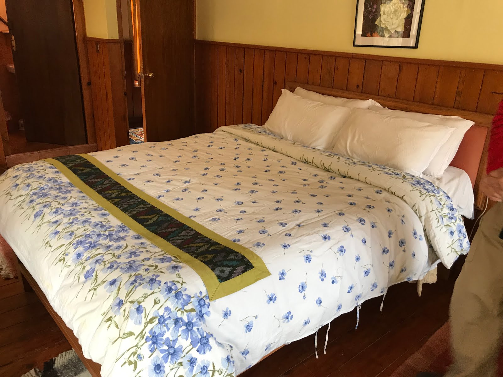
Room with the double size bed
Room with the two twin size beds

Sitting around the sun room enjoying tea


Chicken

Fried rice

Vegetable stew

Vegetarian noodle

Sweet rice dessert

We started our day at Monjo at 9,301 feet or 2,610 meters and we ended up at Namche which is 11,286 feet or 3,440 meters. The distance trekked according to iPhone was 3.8 miles with 8,938 steps and 66 floors climbed. This statistic seemed somewhat low to me because we felt the most tired today. The weather today does show snow. For the next few days the temperature will hover around freezing. We are hoping for a clearer day tomorrow.
. 
Local weather in Celsius


Local weather in Celsius

The suspension bridges is giving me chills but those are some amazing shots! Love the one with the sun peaking through from just one spot in the sky! And it's amazing to arrive at the bazar and see all those buildings there! How in the world did they manage to get all the supplies up in there? WOW! Amazing! Amazing! Did you see any Tibetian mastiffs? I want one. But Steven won't let me. He is concerned about the size of their poop. :)
ReplyDeleteP.S. What happens if you have to use the bathroom during these long treks? I'm asking for a friend. :D
DeleteHi meimei710,
DeleteThank you for reading and commenting. This part of the trek was one of the more challenging ones due to the level of ascent needed to get to Namche Bazaar. There are a few small out houses along the way (usually close to a village) but mostly we only used restrooms when we arrived at our stop.